


Balade de fin d’apres midi

jipjipbobo
User
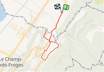

Length
3.8 km

Max alt
428 m

Uphill gradient
153 m
Km-Effort
5.9 km

Min alt
296 m

Downhill gradient
157 m
Boucle
Yes
Creation date :
2023-10-08 15:56:56.0
Updated on :
2023-10-08 17:41:06.204
1h19
Difficulty : Easy

FREE GPS app for hiking
 SityTrail
IGN / Geographical institutes
SityTrail Plus
The world is yours!
About
Trail Walking of 3.8 km to be discovered at Auvergne-Rhône-Alpes, Isère, La Pierre. This trail is proposed by jipjipbobo.
Positioning
Country:
France
Region :
Auvergne-Rhône-Alpes
Department/Province :
Isère
Municipality :
La Pierre
Location:
Unknown
Start:(Dec)
Start:(UTM)
731049 ; 5019289 (31T) N.
Comments